
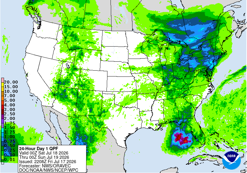
A broad area of low pressure and upper-level energy over the eastern Gulf of Mexico is being monitored for possible tropical development over the next several days. While this system is not expected to become a major storm, it has plenty of tropical moisture to work with — and that could mean heavy rain, thunderstorms, and localized flooding concerns across parts of Florida and the Gulf Coast.
The latest rainfall forecast from NOAA shows the potential for several inches of rain in parts of Florida, especially near the Gulf Coast and across portions of the peninsula. Some areas could see locally higher amounts where thunderstorms repeatedly move over the same locations.
📍 Who should pay attention?
✅ Florida Gulf Coast
✅ Florida Panhandle
✅ Central Florida
✅ Travelers heading to beaches, theme parks, cruises, or outdoor events
🌊 Travel impacts to watch:
- Reduced beach time due to storms and lightning ⚡
- Rougher boating conditions 🌊
- Possible flight delays from thunderstorms ✈️
- Heavy downpours causing ponding on roads 🚗
The big takeaway: don’t focus only on whether it gets a name. Tropical systems that never become storms can still create significant travel headaches with flooding rain and thunderstorms.
Watch for any track, rainfall potential, and any changes in organization closely. Stay weather-aware if your plans take you to Florida or the Gulf Coast over the next few days.